A new World visualized ranking of history’s best-selling books offers a revealing look at what humans across centuries, cultures, and continents have chosen to read, preserve, and pass on.
The FIFA World Cup has never just been about football, but it has been a running record of power, politics and shifting dominance, written every four years since 1930.
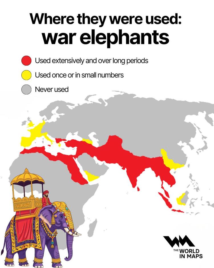
Long before gunpowder and mechanised armies transformed warfare, some of the most decisive battles in history were unexpectedly shaped by elephants.
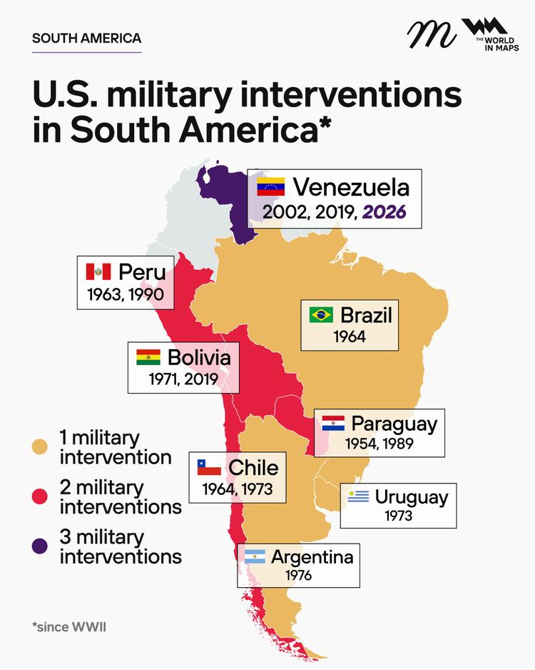
The United States has long played a controversial role in the politics of South America, from quiet backing of coups in the 20th century to unprecedented military action in 2026. This week’s dramatic events in Caracas have once again highlighted that history.
Saturday is simply the start of the weekend, but across Europe, the word carries layers of history shaped by religion, Roman mythology, daily life and social customs.
In today’s fast-paced business world, where many startups struggle to survive beyond five years, there are a few remarkable companies that have been operating for centuries, even more than a millennium.
The Eurovision Song Contest has become one of the world’s most iconic music competitions, uniting countries across Europe (and beyond) in a dazzling celebration of performance, culture, and international camaraderie.
In 1885, Tsar Alexander III of Russia sparked a royal tradition that would become one of the most opulent and iconic legacies in the history of art.
Newspapers have played a crucial role in shaping public opinion and disseminating information for centuries. Despite the digital revolution, several historic newspapers continue to be printed, preserving their rich legacies.
Throughout history, revolutions have been pivotal in shaping societies, governments, and human events.
The history of the world's tallest woman combines medical science and public fascination.
Political leaders have often been at the centre of intense scrutiny and danger throughout history.
The national flags of Europe carry deep historical roots and meaning, with some of the oldest still in use today dating back centuries. These flags not only represent the identity of nations but also tell stories of independence, unity, and legend.